
Tactical Navigation: Building Your Personal Underwater Intel with Buckeye Hunter Hub
Elevating Your Scouting Game
Every seasoned angler knows that the difference between a productive day and a dud often comes down to intimate knowledge of the lake floor. Whether you are hunting for submerged brush piles, identifying hidden drop-offs, or simply noting which boat ramps offer the best access for your specific watercraft, having that data at your fingertips is a game-changer. At Buckeye Hunter Hub, we believe that your should be more than just a visual guide—it should be a repository of your hard-earned experience.
Get in the Community feed
Hunters and anglers nationwide posting bucks, catches, trail cam pics and what's working right now.


The Power of Persistent Data
How many times have you found a magical brush pile on your sonar only to forget exactly where it was a month later? Even with modern GPS units, relying solely on factory-loaded data isn't enough. By manually marking the specific features you discover while on the water, you create a personal archive of your favorite fisheries. This isn't just about finding fish; it’s about understanding the seasonal migrations and holding patterns of the species you target. When you document your findings, you begin to see the story of a lake unfold over time, moving from a guessing game to a calculated pursuit.
Step-by-Step: Marking Your Findings
Using the marking tools on our platform is intuitive, but mastering the workflow will significantly speed up your time spent in front of a screen so you can spend more time on the water. Here is how to build your custom data set:

Youth Hunter Academy
Raise a safe, confident young hunter.
Safety missions for ages 5–17. Free parent account.
1. Identifying the Target
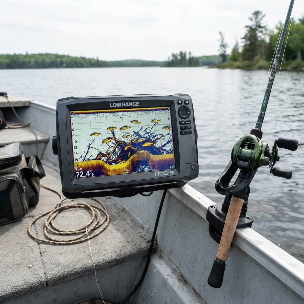
Start by launching the on your mobile device while out on the water or from the comfort of your home. If you are scouting, look for contour line deviations that suggest a drop-off. If you are live-scouting, keep your fish finder active to detect the telltale cluster of branches that signal a crappie-holding brush pile.
2. Dropping the Pin
Once you have located your target, use the 'Add Marker' feature. Tap the screen exactly where the structure sits. We recommend using a color-coding system to keep your map organized. For example, use red pins for safety hazards or boat ramps, blue for drop-offs, and green for established brush piles or artificial reefs. Consistent labeling is key to maintaining a clean, actionable map.
3. Adding Descriptive Notes
Simply dropping a pin is helpful, but adding context is what makes you an elite angler. In the marker notes field, jot down the depth you were at when you found it, the time of day, and the species you were targeting. If you noticed a specific pattern—such as the fish only holding on the 'down-current' side of a drop-off—make a note of it. These small details will trigger your memory months or even years later.
4. Reviewing and Refining
Periodically review your marked spots in archive of tips to see how others are interpreting similar terrain. You might find that the structures you are marking are consistent with common patterns discussed by regional experts. Always cross-reference your findings with , such as your state’s Department of Natural Resources, which often provide public maps of artificial reefs or fish attractors that you can import or cross-verify against your own discoveries.
Why Precision Matters
There is a massive psychological difference between fishing a 'general area' and fishing a 'specific point.' When you return to a marked brush pile, you aren't just wetting a line; you are approaching that structure with confidence. You know the exact orientation of the pile, the depth the fish should be suspended at, and the best angle to approach so you don't spook the school. This precision is the hallmark of the professional angler.
Moreover, by taking the time to catalog these areas, you become a better steward of the water. You learn where the sensitive habitats are located and can fish more effectively without damaging the very ecosystems that sustain our sport. For more insights on how to handle different aquatic environments, check out our extensive guides at .
Utilizing Public Data Streams
While personal exploration is paramount, don't ignore public data. Organizations like the U.S. Fish and Wildlife Service often provide data on public access points and habitat restoration projects. When you find a public brush pile, drop a marker on your hub map immediately. Combine this with your own unique findings to create a comprehensive 'hotspot grid.'
Sharing and Community Growth
Fishing is best when it's a shared passion. Once you've had a successful day hitting your marked spots, we encourage you to share your results on the . Seeing the success of other anglers can provide the inspiration to refine your own techniques and explore new areas of the map. By contributing to the community, you help others understand which patterns are currently working, creating a cycle of knowledge that benefits everyone from the novice to the tournament pro.
Remember, your map is a living document. As seasons change and water levels fluctuate, update your markers. A brush pile that was a goldmine in the spring might be too shallow in the heat of summer. By staying diligent with your marking, you ensure that you are always fishing at the highest level of efficiency possible.
Catch more these fish — free
Create a free account and unlock the full angling toolkit: