
Unlocking Precision: Customizing Your Digital Waterscape with Buckeye Hunter Hub
Elevating Your Scouting Game
Every seasoned angler knows that fishing is 10% casting and 90% preparation. You can have the most expensive rod and the latest lures, but if you aren't placing your bait in front of fish, you’re just practicing your cast. The difference between a ‘lucky’ day and a consistent season often comes down to your ability to recognize and store key structural data. With the provided by Buckeye Hunter Hub, you have more than just a navigational tool—you have a personal, evolving database of every productive mile of water you visit.
Get in the Community feed
Hunters and anglers nationwide posting bucks, catches, trail cam pics and what's working right now.


The Power of Geo-Tagged Intelligence
Finding a brush pile or a steep drop-off is often the hardest part of the trip. Once you find that secret spot where the bass are staging or the crappies are suspending, the goal is to make sure you can find that exact coordinate on your next outing, regardless of wind conditions or boat drift. Using the marking features on Buckeye Hunter Hub allows you to build a digital history of your success.
By layering your own markers over the base map, you create a personalized heatmap of underwater activity. Whether it is a submerged log jam that only shows up on your sonar or a boat ramp that stays navigable during low-water cycles, recording these points allows you to build a reliable blueprint of your favorite fisheries. You can also cross-reference your findings with to ensure that your marked spots comply with local regulations, such as protected spawning zones or gear restrictions.
Step-by-Step: How to Mark Your Hotspots

Youth Hunter Academy
Raise a safe, confident young hunter.
Safety missions for ages 5–17. Free parent account.
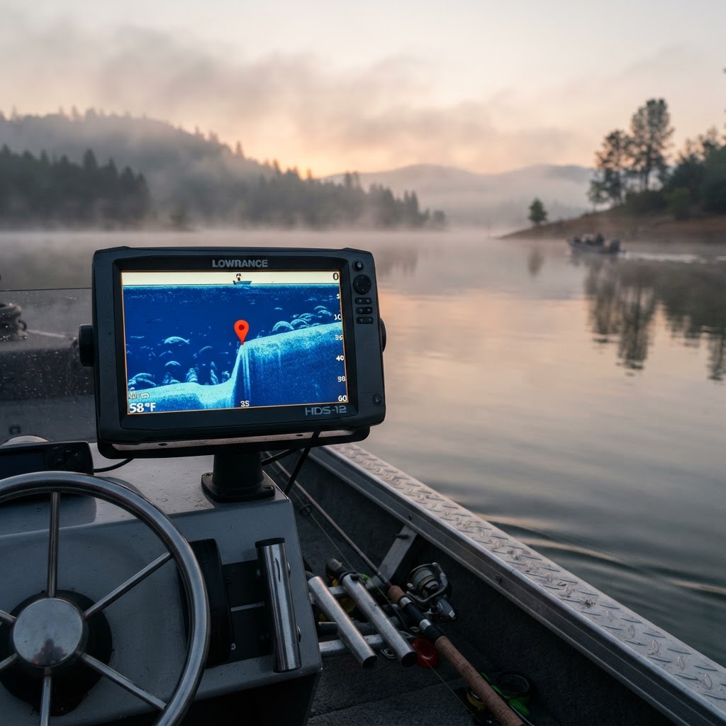
- Identify the Architecture: Whether you are using side-scan sonar or traditional depth finders, look for distinct structural changes. A brush pile will often appear as an irregular, dense cluster on the bottom, while a drop-off will show a sharp contour transition.
- Engage the Pin-Drop Tool: Open the Buckeye Hunter Hub map interface on your mobile device while on the water. When you identify a point of interest, tap the marker icon. You will be prompted to name the point; be specific, such as 'North-Point-Brush-Pile-12ft' or 'Main-Channel-Break'.
- Add Descriptive Notes: The true utility lies in the details. Use the note-taking feature to add metadata. Note the water temperature, the time of day, and the specific lure that triggered the bite at that spot. This level of detail turns a simple coordinate into a strategy guide for future seasons.
- Organize by Category: Use the layer settings to categorize your markers. Color-coding your pins—using red for drop-offs, green for cover, and blue for boat ramps—allows you to toggle your display based on what you are targeting that day.
Navigating Complex Terrain
Understanding the bottom composition is critical, but don't overlook the logistics of the shoreline. Marking boat ramps is a practical step that many anglers skip until they encounter a poorly marked launch in the dark. By tagging your launch sites, you ensure that you can transition from the truck to the water without friction. For those looking to dive deeper into regional regulations or species-specific behavior, check out the resources provided by the U.S. Fish and Wildlife Service to stay updated on habitat conservation efforts in your area.
As your collection of pins grows, you will start to see patterns. You might notice that during the summer drawdown, the fish shift from the shallow brush piles to the deeper drop-offs you’ve marked. This is where your data becomes a predictive tool rather than just a memory aid. You aren't just fishing for the moment; you are fishing for the season.
Building Your Personal Library
Consistency is the hallmark of a successful angler. When you return to a lake months later, you don't want to spend half your day relearning the topography. By maintaining your markers on the Buckeye Hunter Hub platform, you ensure that your scouting time is never wasted.
If you find a new pattern or pull a trophy out of one of your marked brush piles, consider sharing your success on our . It is a fantastic way to see how other anglers are interpreting the same terrain. We also regularly publish technical breakdowns and seasonal strategies on , where we discuss how to adapt these mapping techniques to changing water levels and temperatures.
Final Thoughts on Mapping
Data is only as good as your ability to interpret it. Don't be afraid to delete markers for spots that have stopped producing—habitats change, silt moves, and brush piles deteriorate. Keeping your map current is just as important as creating it. By treating your digital map as a living document, you’ll find yourself spending less time searching and significantly more time with a tight line.
Catch more these fish — free
Create a free account and unlock the full angling toolkit: