
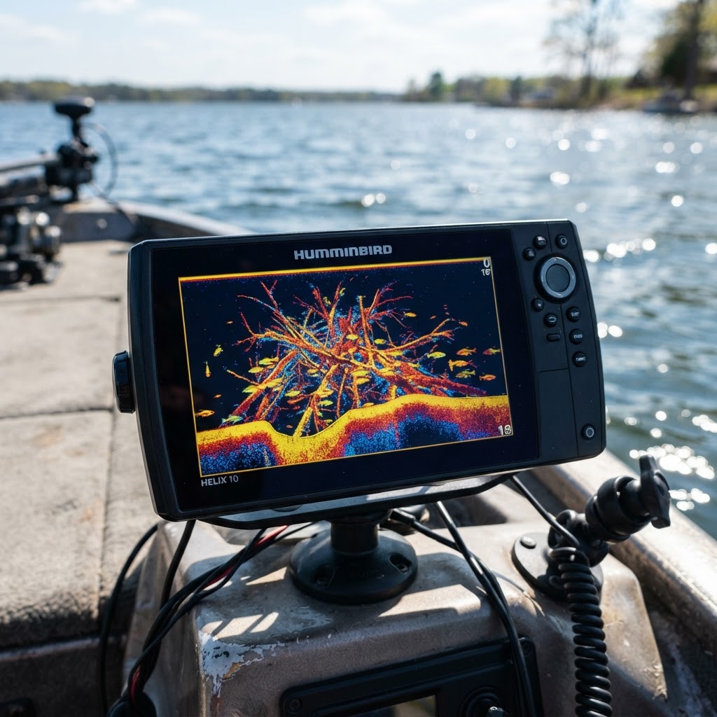
Precision Scouting: Developing Your Underwater Memory Bank
Elevate Your Scouting Game
Every seasoned angler knows that the difference between a 'just okay' day on the water and a banner haul often comes down to the details. While a quality fish finder reveals what is happening in real-time, the true professional carries a mental—or better yet, a digital—archive of the lake's topography. Utilizing a is no longer a luxury; it is a foundational skill for those who want to transition from casual hobbyist to consistent, successful fisherman.
Get in the Community feed
Hunters and anglers nationwide posting bucks, catches, trail cam pics and what's working right now.


At Buckeye Hunter Hub, we believe that your intelligence gathering should be as fluid as the water you fish. Whether you are targeting suspended crappie near a submerged bridge or hunting for smallmouth holding on a structural drop-off, the ability to mark, store, and return to these spots is what separates the veterans from the novices. In this guide, we will walk through the process of building your personal underwater archive using our digital tools.
Why Precision Marking Matters
Fish are creatures of habit, but they are also subject to the whims of water temperature, oxygen levels, and current. If you find a brush pile today that is holding a school of massive bluegill, the chances are high that the same habitat will hold fish under similar conditions next season.
Many anglers rely on their memory, but memory is fickle. By using the marking features on our platform, you create a permanent record. This allows you to plan your day based on verified historical data rather than hope. When you arrive at a new body of water, you can check for access points and regulations, then cross-reference those with your saved markers to determine the most logical path for your day.

Youth Hunter Academy
Raise a safe, confident young hunter.
Safety missions for ages 5–17. Free parent account.
Step-by-Step: Dropping Pins with Intent
Learning to use the Buckeye Hunter Hub interface is intuitive, but there is a distinct strategy to how you organize your data. Follow these steps to build a robust database of your personal hotspots.
1. Identifying the Structural Targets
Before you ever launch the boat, spend time studying satellite imagery and bathymetric data on the map. Look for sharp changes in contour—these are your drop-offs. If you see a point that extends deep into the main lake basin, mark the transition point. Once on the water, confirm these spots with your sonar.
2. Executing the Pin-Drop
When you find a piece of structure worth noting, tap the location on your screen to open the interface. Instead of just dropping a generic pin, use the labeling feature to categorize your mark. Use consistent naming conventions: 'Brush Pile_North_Point' or 'Ramp_A_Winter_Access.' By using these descriptive titles, you can filter your map layer later to see only specific types of structure, like ramps or deep-water brush.
3. Adding Descriptive Metadata
Don't just mark the spot; note the conditions. Did you catch a trophy bass here during a spring rain? Mention the water clarity or the specific lure used in the marker's notes section. You can even upload a photo of your success directly to the to link that specific spot to a memorable trophy, providing a visual anchor for your memories.
Advanced Habitat Management
Once you have a dozen or more pins, it is time to shift from collecting data to analyzing patterns. If you notice that your successful bass marks are all clustered around rock-transition zones at a depth of 15-20 feet, you have just discovered a seasonal pattern.
For those looking for official guidance, it is always wise to consult the U.S. Fish and Wildlife Service regarding local habitat protection projects or recent fish stocking data. Often, state-managed fish attractors are marked on public maps, and you can add these to your personal map layer to create a master guide for your region.
The Iterative Process of Improvement
Fishing is rarely a 'set it and forget it' endeavor. Structure changes. Brush piles silt in, and launch ramps can become unusable due to low water levels. Your digital map should be a living document. After every trip, take five minutes on or via our map interface to update your notes. If a spot was dry, note the date and conditions. If it produced a limit, save the details.
This disciplined approach to data management transforms the way you view a lake. You stop seeing it as a vast, intimidating expanse of water and start seeing it as a grid of high-probability locations. Over time, you will develop a 'circuit' of spots that you can trust regardless of the pressure or time of day.
By leveraging the tools provided by Buckeye Hunter Hub, you are not just marking spots; you are building an investment in your future angling success. So, next time you head out, don't just fish—gather intel, document your findings, and refine your approach one pin at a time.
Free every morning
Your Daily Briefing
One morning forecast for the spots you actually hunt and fish: deer movement, waterfowl flights, bite times, wind and shooting light.
See what's in itSet up your briefing
Join free, save a spot on the map, then pick what you hunt and fish and when you want your email.
Catch more these fish — free
Create a free account and unlock the full angling toolkit: