
Mapping Your Success: A Tactical Approach to Digital Charting
Navigating the Digital Frontier: Why Mapping Matters
Every seasoned angler knows that the secret to a successful day on the water isn't just about the gear you use; it is about knowing exactly where the fish are hiding. Whether you are chasing summer largemouth bass in deep-water structure or hunting for walleye near steep drop-offs, having a reliable way to mark your findings is a game-changer. By using our , you can transform your local lake into a readable, navigable blueprint.
Get in the Community feed
Hunters and anglers nationwide posting bucks, catches, trail cam pics and what's working right now.


Understanding the Anatomy of a Hotspot
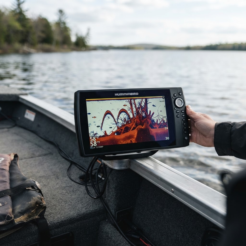
Before you begin placing digital pins, it is important to identify what you are actually looking for. Fish gravitate toward specific underwater features that provide cover, oxygen, and ambush opportunities. Brush piles, for instance, are classic magnets for crappie and bass. These man-made or natural clusters of timber offer a sanctuary where smaller baitfish hide, inevitably drawing in the predators you want to catch. Similarly, steep drop-offs act as underwater highways, allowing fish to transition rapidly from shallow feeding grounds to deep-water security. Finally, boat ramps are often overlooked as structural markers, but understanding the depth contours around your launch point can prevent prop damage and help you identify early morning travel lanes for baitfish.
Getting Started with Buckeye Hunter Hub Mapping
Once you have loaded our , the process of cataloging your findings is intuitive and efficient. Start by toggling the layer view to 'Satellite' or 'Topographic' depending on your specific lake. If you are exploring a new reservoir, visit the page to see if there are public bathymetric records available, which can provide a base layer for your exploration.
Raise a safe, confident young hunter.
Guide your kids ages 5–17 through interactive hunting safety missions, real decision drills, and earned trophies — all from one free parent account.




Step-by-Step Pinning
- Locate your area of interest using the search bar or by manual navigation.
- Once you find a piece of structure on the sonar or depth map, select the 'Add Marker' icon in the toolbar.
- Click directly on the precise coordinates of the brush pile or ledge.
- Add a specific note in the description box, such as 'depth: 15ft' or 'bait present'.
- Save the pin to your private account to ensure it remains accessible for your next trip.
By keeping your notes organized, you can easily review your findings on when planning your next weekend excursion. Taking these small steps creates a mental map that grows more detailed with every trip you take.
Leveraging Data for Better Results
Why do we go through the trouble of marking these spots? Because fish are creatures of habit. If you catch a quality bass off a specific brush pile in mid-June, there is a very high probability that another fish will occupy that same spot next year. Using digital markers allows you to return to the exact spot regardless of wind conditions or low visibility. If you are fishing in a state managed by the U.S. Fish & Wildlife Service, checking their habitat restoration reports can often provide clues about where new artificial structures have been placed, giving you a head start on finding productive areas.
The Power of Community and Personal Records
While personal markers are the backbone of your strategy, engaging with the broader angling community can also provide invaluable insights. After you have successfully utilized your map to land a trophy, consider sharing your triumph on our . This isn't just about showing off; it is about building a body of knowledge that helps all anglers understand which patterns are working in real-time. When you see others reporting success near specific depth ranges or structure types, you can correlate that data with your own markers to refine your tactical approach.
Staying Organized for Long-Term Success
Do not let your digital workspace become cluttered. Periodically review your pinned locations and delete those that are no longer productive or were only seasonal successes. Think of your mapping tool as a living document. By consistently cleaning up your markers and adding new, relevant details, you ensure that your next trip is built on the most accurate information possible. Remember, the goal of modern angling is to spend more time with a line in the water and less time guessing where the fish might be. With the tools provided by Buckeye Hunter Hub, you have the capability to turn every outing into an educational experience, building a database of knowledge that will serve you for years to come. Whether you are a beginner learning the basics of contour lines or an expert looking to streamline your tournament preparation, precision mapping is the key to unlocking your full potential on the water.
Catch more these fish — free
Create a free account and unlock the full angling toolkit: